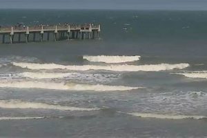
Information pertaining to wave conditions, tides, and weather patterns along the Pensacola, Florida coastline is crucial for individuals engaged in surfing and related water activities. These synthesized summaries, often available online, provide insights into factors that influence the quality of the surf, such as wave height, swell direction, and wind speed. For example, a report indicating offshore winds and a building swell from the southeast would suggest favorable conditions for surfing.
Access to timely and accurate coastal data offers several advantages. It allows surfers to make informed decisions regarding when and where to pursue their sport, maximizing their enjoyment and minimizing potential risks associated with hazardous conditions. Furthermore, understanding the area’s coastal dynamics contributes to a broader appreciation of its natural environment and the forces that shape it. Historically, surfers relied on observation and local knowledge; the modern availability of detailed reports represents a significant advancement in their ability to plan their activities.
The following sections will delve into the specific elements contained within these coastal updates, including the interpretation of wave height and period, the impact of wind direction and speed, and the significance of tidal information for safe and successful surfing endeavors in the Pensacola region.
Tips for Utilizing Pensacola Coastal Condition Summaries
Effective utilization of coastal condition summaries requires a thorough understanding of their components and implications for water activities.
Tip 1: Consult Multiple Sources: Do not rely solely on a single source. Cross-reference information from various websites and weather services to obtain a comprehensive overview of current and anticipated conditions.
Tip 2: Interpret Wave Height and Period: Wave height indicates the vertical distance between the crest and trough of a wave. Wave period refers to the time interval between successive crests. Longer wave periods generally translate to more powerful waves, even at moderate heights.
Tip 3: Analyze Wind Direction and Speed: Offshore winds are typically favorable, creating cleaner and more defined wave faces. Onshore winds can disrupt wave formation and create choppy conditions. Wind speed influences wave size and stability.
Tip 4: Consider Tidal Fluctuations: Tidal variations affect water depth and wave breaking patterns. Low tide may expose shallow reefs or sandbars, while high tide can increase wave size and impact currents.
Tip 5: Assess Swell Direction: Swell direction indicates the angle from which waves are approaching the coastline. Understanding the prevailing swell direction is crucial for identifying locations that will receive the most consistent waves.
Tip 6: Monitor Local Weather Forecasts: Pay attention to forecasts for rain, thunderstorms, and other adverse weather conditions. These factors can significantly impact water visibility and create hazardous situations.
Tip 7: Observe Conditions On-Site: Always visually assess conditions upon arrival at the beach. Coastal summaries provide valuable information, but direct observation allows for a final evaluation of safety and suitability.
By consistently applying these recommendations, individuals can maximize the benefits derived from coastal condition summaries and make informed decisions regarding their water activities.
The article will now proceed to discuss specific locations in the Pensacola area known for surfing and how to interpret the information in relation to those locations.
1. Wave Height
Wave height, a core component of any coastal condition summary for Pensacola, Florida, provides essential information for individuals planning water activities. This metric, representing the vertical distance between the crest and trough of a wave, directly impacts the suitability of the surf for various skill levels and activities.
- Significance for Surfing
For surfers, wave height is a primary determinant of rideability. A report indicating small wave heights (e.g., 1-2 feet) suggests conditions suitable for beginners or longboarding. Conversely, larger wave heights (e.g., 4-6 feet or more) cater to experienced surfers seeking challenging rides. The consistency of the reported wave height is also important; a rapidly fluctuating wave height can indicate unstable and less predictable surf conditions.
- Impact on Other Water Activities
Wave height considerations extend beyond surfing. Kayaking and stand-up paddleboarding become more challenging and potentially hazardous with increased wave height. Swimmers should be aware that even moderate wave heights can create strong currents and undertows, particularly for inexperienced individuals. Fishing from shore can also be impacted, as larger waves can make casting and retrieving lines more difficult and dangerous.
- Measurement and Reporting Inconsistencies
It is important to acknowledge potential inconsistencies in wave height reporting. Different sources may use different measurement techniques or reporting standards, leading to variations in the reported wave heights. Additionally, wave height can change rapidly due to local weather patterns or tidal influences. Therefore, consulting multiple sources and observing conditions on-site are crucial for accurate assessment.
- Relationship to Wave Period
While wave height provides a measure of the wave’s size, it should be considered in conjunction with the wave period. A larger wave height with a short wave period may indicate a steeper, more powerful wave. A larger wave height with a longer period will often produce a smoother, more rolling wave. Both wave height and wave period are crucial measurements for making informed decisions about enjoying the area’s coastal waters.
In summary, wave height serves as a foundational element within coastal condition summaries for Pensacola, Florida. Its interpretation, in conjunction with other factors like wave period, wind conditions, and local forecasts, enables individuals to make informed decisions regarding their safety and enjoyment of the area’s coastal environment.
2. Swell Direction
Swell direction, a critical element within a coastal report, dictates the angle at which waves approach the Pensacola, Florida coastline. The effectiveness of a given coastal area’s design relative to a particular swell direction influences how successfully wave energy will propagate, ultimately impacting the size and quality of surf at different locations. For example, a south swell will generally produce larger waves at beaches facing south, while a north swell will have less impact. Knowing the swell direction is, therefore, fundamental to understanding where waves are likely to break most favorably.
The practical significance of understanding swell direction is evident in wave forecasting and surf spot selection. Coastal conditions reports provide details on swell direction in degrees or compass points, allowing surfers to predict wave arrival times and potential wave size at specific breaks. Moreover, knowing swell direction allows for discrimination in selection: one location may be sheltered from the swell and create smaller, gentler surf, while another may be fully exposed, resulting in larger, more challenging conditions. Without such insight, time may be wasted traveling to less-than-optimal locations for the swell conditions.
In summary, accurate measurement and reporting of swell direction are crucial for the predictive utility of coastal updates relevant to Pensacola, Florida. It directly influences wave formation, breaking characteristics, and surf quality at different locations along the coastline. While other parameters in a summary, such as wind and tide, also play a significant role, swell direction serves as a primary indicator of wave potential, guiding decisions related to surfing and other water-based activities.
3. Wind Speed
Wind speed, a critical component of coastal forecasts relevant to Pensacola, Florida, directly impacts wave quality and overall suitability for water activities. Its effects are multifaceted, influencing wave formation, breaking patterns, and surface conditions, all of which are essential considerations detailed within coastal condition summaries.
- Onshore Winds and Choppy Conditions
Onshore winds, blowing from the sea towards the land, typically degrade surf quality. They generate choppy conditions, disrupting the smooth wave faces preferred by surfers. Strong onshore winds can flatten waves entirely, rendering surfing impossible. Coastal reports highlight wind direction and speed, alerting users to potential deterioration in water conditions due to onshore flow. For example, a coastal report indicating 15-20 knot onshore winds signals unfavorable conditions for surfing.
- Offshore Winds and Clean Wave Faces
Offshore winds, blowing from the land towards the sea, generally improve surf quality. These winds groom wave faces, creating cleaner, more defined breaks. Light to moderate offshore winds can hold up waves, allowing them to break more slowly and predictably. However, excessively strong offshore winds can cause waves to close out rapidly, reducing rideable sections. A coastal report mentioning light offshore winds is a positive indicator for favorable surf conditions.
- Wind Speed Thresholds and Activity Suitability
Different wind speed thresholds dictate the suitability of Pensacolas coastal waters for various activities. Light winds (0-10 knots) generally pose minimal disruption, allowing for comfortable swimming, kayaking, and paddleboarding. Moderate winds (10-20 knots) can create challenging conditions for less experienced individuals, while stronger winds (20+ knots) may render many activities unsafe. Coastal reports provide wind speed data, enabling users to assess the appropriateness of the conditions for their chosen activity.
- Influence on Rip Current Formation
Wind speed, particularly in conjunction with wave action and tidal fluctuations, plays a role in rip current formation. Strong winds blowing parallel to the shoreline can contribute to the development of these dangerous currents. Coastal summaries may include information on rip current risk, often correlated with wind speed and wave height. Awareness of wind-induced rip current potential is crucial for swimmer safety.
In summary, wind speed represents a key determinant of Pensacola coastal conditions, influencing wave quality, safety, and suitability for a range of activities. Coastal condition summaries integrate wind speed data, empowering users to make informed decisions and mitigate potential risks associated with adverse weather conditions.
4. Tidal Influence
Tidal influence is an indispensable factor in comprehending coastal dynamics, particularly as it relates to wave conditions off Pensacola, Florida. Integrating tidal data into the interpretation of coastal condition summaries enhances the predictive accuracy for surfers and other water enthusiasts.
- Water Depth Modulation
Tidal fluctuations directly alter water depth along the coastline. Lower tides may expose sandbars or reefs, modifying wave breaking patterns and potentially creating hazardous conditions for navigation. Conversely, higher tides increase water depth, allowing waves to propagate further inshore and potentially producing larger surf. A coastal condition summary failing to incorporate tidal information omits a crucial determinant of local wave characteristics.
- Current Generation
The movement of water associated with rising and falling tides generates currents. These tidal currents can significantly impact surfing conditions, particularly in inlets or near structures. Strong tidal currents may create challenging conditions, making it difficult to paddle into waves or maintain position. Coastal condition reports often include information on tidal currents to assist users in assessing potential hazards. Failure to recognize the presence and strength of tidal currents can lead to dangerous situations.
- Wave Breaking Characteristics
Tidal stage affects wave breaking characteristics at different locations. Some surf breaks function optimally at high tide, while others perform better at low tide. The tidal stage can influence wave shape, size, and consistency. A coastal condition assessment should specify the optimal tidal window for surfing at various locations along the Pensacola coastline. Surfers who ignore tidal influence risk missing the best conditions or encountering unexpectedly poor surf.
- Beach Accessibility
Tidal cycles impact beach accessibility. High tides may inundate sections of the beach, reducing available space and potentially restricting access to certain surf spots. Low tides can expose more beach area, facilitating access but also revealing submerged hazards. Coastal condition advisories often include information on beach accessibility in relation to tidal stage. Proper planning requires awareness of how tides affect physical access to the coast.
In conclusion, tidal influence constitutes a fundamental element within the framework of coastal condition updates for Pensacola, Florida. Accurate interpretation of these advisories necessitates consideration of tidal stage, current patterns, wave breaking behavior, and beach access constraints. Integration of tidal data enhances the informational value of coastal assessments, leading to safer and more rewarding experiences for all coastal users.
5. Water Temperature
Water temperature constitutes a significant parameter within coastal weather summaries, directly affecting the comfort and safety of individuals engaged in water activities near Pensacola, Florida. This factor, consistently monitored and reported, influences decisions regarding appropriate attire and exposure time, thereby playing a crucial role in preventative safety measures.
The cause-and-effect relationship between water temperature and its impact on individuals is straightforward: lower water temperatures can lead to hypothermia, impacting physical and mental capabilities. As a result, coastal weather reports invariably incorporate water temperature readings, allowing individuals to select appropriate thermal protection, such as wetsuits or rash guards. For instance, a water temperature reading below 70F often prompts recommendations for wetsuit usage to mitigate the risk of hypothermia during extended periods in the water. The absence of water temperature data would represent a critical omission, diminishing the utility of the report for informed decision-making. Reports will also include any presence of marine life and the dangers associated with it.
In summary, water temperature data is indispensable for individuals utilizing Pensacola’s coastal waters. Its inclusion within coastal reports directly impacts safety considerations, influencing the selection of appropriate gear and mitigating the risks associated with prolonged exposure to cooler waters. Recognizing the importance of this parameter contributes to more responsible and enjoyable coastal experiences.
6. Local Forecast
The local forecast is an integral component of a comprehensive coastal weather summary. This element provides predictions regarding atmospheric conditions, encompassing wind speed and direction, precipitation probability, and potential for severe weather events. Integration of this predictive data into the coastal weather report enhances the report’s utility, offering a more complete picture of prevailing and anticipated environmental circumstances. For example, a forecast indicating approaching thunderstorms necessitates immediate cessation of water activities and evacuation of the beach. The lack of local forecast data renders the coastal weather information incomplete, limiting its efficacy in supporting informed decision-making.
Consider a scenario where a detailed coastal weather summary contains predictions of increasing wind speeds coupled with a high probability of thunderstorms within the next few hours. Surfers and swimmers in the area would be alerted to the imminent danger, enabling them to take appropriate action, such as leaving the water and seeking shelter. This real-time predictive capability is particularly critical in a region prone to sudden weather changes. The predictive validity of the local forecast, verified against historical accuracy, strengthens user confidence in its application. Therefore, quality control measures and validation processes are important, improving the usability of the report.
In summary, the inclusion of the local forecast within a coastal weather summary significantly enhances the report’s value and its practical applicability. By combining current conditions with predictive insights, coastal users are empowered to make informed choices, mitigating risks associated with adverse weather events and optimizing their enjoyment of the coastal environment. Dissemination channels should be resilient and frequently updated, ensuring accessibility of this critical information to all relevant stakeholders.
7. Rip Currents
Rip currents pose a significant hazard along the Pensacola, Florida coastline, and consequently, information regarding rip current risk is a critical component of a responsible coastal condition advisory. These strong, localized currents flow away from the shore, posing a threat to swimmers and surfers who may be inadvertently swept offshore. The intensity and frequency of rip currents are influenced by a complex interplay of factors, including wave action, tidal stage, and nearshore bathymetry. For example, after a period of high wave energy, an increased risk of rip currents is commonly observed, as the wave action facilitates their formation. Recognizing and understanding the dynamics of rip currents is essential for water safety.
Coastal condition reports should explicitly address the current risk level for rip currents, often categorizing the risk as low, moderate, or high. Such reports frequently include information on the specific locations where rip currents are more likely to occur, such as near piers or jetties. A report indicating a “high” risk of rip currents at a popular beach warrants significant caution and may discourage swimming altogether. Furthermore, these advisories often provide visual indicators to aid in the identification of rip currents, such as breaks in the wave pattern or discoloration of the water. Educational initiatives coupled with effective communication of rip current risks are paramount to minimizing incidents.
In summary, rip current information is an indispensable element of any credible coastal weather report in Pensacola, Florida. The inclusion of this information, along with clear visual indicators and educational resources, contributes directly to the safety and well-being of beachgoers. Ongoing research and improved predictive modeling of rip current behavior are essential for enhancing the accuracy and effectiveness of these warnings, reducing the potential for accidents and ensuring responsible enjoyment of the coastal environment.
Frequently Asked Questions
The following addresses common inquiries regarding coastal condition summaries for Pensacola, Florida, offering insights into their interpretation and application.
Question 1: What constitutes a “pensacola florida surf report,” and where can it be accessed?
A “Pensacola Florida surf report” is a compilation of data describing current and predicted coastal conditions relevant to surfing and other water activities. These reports typically include information on wave height, swell direction, wind speed, tidal stage, and water temperature. They can be accessed through various online platforms, including dedicated surf forecasting websites, weather service websites, and mobile applications specializing in coastal data.
Question 2: How frequently are “pensacola florida surf reports” updated, and how does this impact their reliability?
The update frequency varies depending on the source, ranging from hourly to multiple times daily. More frequent updates generally enhance reliability, as they reflect the dynamic nature of coastal conditions. Users should note the timestamp of the report to assess its currency and relevance to present conditions. Relying on outdated information may lead to inaccurate assessments of safety and surf quality.
Question 3: Why do different “pensacola florida surf report” sources sometimes provide conflicting information?
Discrepancies among different sources may arise due to variations in data collection methods, measurement locations, and forecasting models. Some sources may rely on automated buoys, while others incorporate human observations. Users should consult multiple sources and cross-reference information to obtain a comprehensive understanding of coastal conditions. When significant discrepancies exist, prioritizing data from reputable and established sources is advisable.
Question 4: What level of expertise is required to accurately interpret a “pensacola florida surf report?”
While specialized expertise is not strictly required, a basic understanding of wave dynamics, weather patterns, and coastal processes is beneficial. Familiarity with terms such as “swell period,” “offshore winds,” and “tidal range” enhances comprehension and facilitates informed decision-making. Resources are available online and in print to assist individuals in developing their understanding of coastal meteorology and surf forecasting.
Question 5: How can a “pensacola florida surf report” assist in ensuring water safety?
A surf report provides critical information for assessing potential hazards. By evaluating wave height, wind speed, and rip current risk, individuals can determine the suitability of the conditions for their skill level and activity. The report also provides insights into potential weather changes, allowing users to prepare for adverse conditions or seek shelter if necessary. Prudent use of this information contributes significantly to water safety.
Question 6: Are “pensacola florida surf reports” solely for surfers, or can they benefit other coastal users?
While primarily targeted towards surfers, coastal condition summaries offer valuable information for a wide range of coastal users. Swimmers, kayakers, paddleboarders, and anglers can all benefit from understanding wave height, wind conditions, and tidal patterns. Beachgoers can also use these reports to assess beach accessibility and potential hazards. Therefore, these reports serve as a valuable resource for anyone engaging in activities near the Pensacola, Florida coastline.
In summary, Pensacola coastal condition reports are a valuable tool for anyone engaging in activities on or near the water. Understanding the information provided within the report and combining it with personal observation leads to a safer and more enjoyable experience.
The subsequent section will provide resources for finding and further understanding coastal weather conditions.
Pensacola Florida Surf Report
This exploration of the “pensacola florida surf report” has illuminated its multi-faceted nature and critical role in facilitating informed decision-making along the Pensacola coastline. The analysis has underscored the importance of understanding key parameters such as wave height, swell direction, wind speed, tidal influence, and water temperature. It has also highlighted the necessity of considering local forecasts and rip current risks when assessing coastal conditions.
Access to and diligent application of a “pensacola florida surf report” empowers individuals to engage with the coastal environment responsibly and safely. Continuous improvement in data collection methodologies, predictive modeling, and dissemination channels will further enhance the efficacy of these reports. The future of coastal safety hinges on the ongoing commitment to providing accurate, accessible, and actionable information to all stakeholders.


