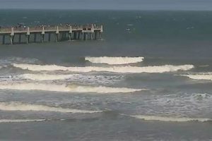
Information regarding wave conditions, including height, period, and direction, at a specific coastal location is vital for water sports enthusiasts. Accurate, timely data allows individuals to assess the suitability of conditions for activities such as surfing, swimming, and boating. For example, a detailed analysis might reveal small wave heights and long wave periods, indicating ideal conditions for beginner surfers or paddleboarders.
Access to current and predicted oceanographic data provides significant advantages. Safety is paramount, and informed decisions based on reliable reports can minimize risks associated with strong currents or hazardous wave activity. Furthermore, understanding prevailing trends allows for optimal planning of recreational outings, maximizing enjoyment and minimizing wasted time due to unfavorable circumstances. Historical data contributes to a broader understanding of seasonal patterns and long-term coastal dynamics.
The following sections will delve into specific aspects influencing nearshore conditions, data sources, and resources available to inform decisions related to ocean activities. Subsequent analysis will also examine the various factors that can affect the dependability of the information and provide guidelines on how to best interpret available details.
The following guidelines offer a framework for interpreting and utilizing publicly available coastal condition analyses for the purpose of maximizing safety and enjoyment.
Tip 1: Consult Multiple Sources: Cross-reference data from several independent providers to establish a comprehensive overview. Varying methodologies and observation points can lead to differing results. Reviewing multiple sources can mitigate inaccuracies.
Tip 2: Understand Wave Height Measurement: Be aware that reported values often represent significant wave height, which is the average of the highest one-third of waves. Individual waves can exceed this average, potentially presenting unexpected hazards.
Tip 3: Analyze Wave Period: Wave period, the time between successive wave crests, is crucial for understanding wave energy. Longer periods generally correlate with increased power and potentially stronger currents.
Tip 4: Assess Wind Conditions: Wind direction and speed significantly impact wave formation and stability. Onshore winds can create choppy, disorganized conditions, while offshore winds tend to produce smoother, more predictable waves.
Tip 5: Consider Tide Levels: Tidal fluctuations alter water depth and can affect current strength. Low tide may expose hazards, while high tide can exacerbate rip currents.
Tip 6: Be Aware of Local Knowledge: Consult with experienced local surfers or lifeguards for insights into specific areas, including hidden hazards or localized current patterns.
Tip 7: Heed Warnings and Advisories: Pay close attention to any posted warnings or advisories issued by local authorities. These alerts often indicate potentially dangerous conditions that warrant caution or avoidance.
Adhering to these guidelines empowers individuals to make well-informed judgments, enhancing both safety and the overall experience of engaging in water-based activities. Diligence in assessment is paramount to responsible coastal recreation.
The subsequent section will address frequently asked questions regarding coastal safety and effective use of publicly accessible coastal condition information.
1. Wave Height
Wave height serves as a fundamental component of the information provided in a coastal conditions analysis. It dictates the suitability of the marine environment for various activities and significantly influences safety parameters. Its reliable evaluation is essential for individuals seeking to navigate nearshore waters responsibly.
- Significance for Surfing Activity
Reported values directly correlate with the size and power of breaking waves. Surfers use this data to determine the feasibility of catching waves and the level of skill required to navigate the conditions. An analysis indicating excessively large heights signals potentially hazardous conditions for all but the most experienced practitioners.
- Influence on Swimming Safety
Excessive wave action can pose a significant risk to swimmers, particularly children and inexperienced individuals. Larger waves can create strong currents and undertows, making it challenging to stay afloat and increasing the risk of being swept out to sea. The presence of large surf necessitates heightened vigilance and caution near the water’s edge.
- Impact on Boating Operations
Navigating vessels in areas with elevated wave heights demands considerable skill and experience. Larger waves can make it difficult to maintain control of a boat, increasing the risk of capsizing or damage. Mariners rely on data to assess potential hazards and adjust their routes or activities accordingly.
- Role in Coastal Erosion Dynamics
Increased wave action accelerates erosion rates along coastlines. The energy of incoming waves wears away at shorelines, potentially damaging infrastructure and altering the landscape. Accurate measurements contribute to a better understanding of coastal processes and support the implementation of effective mitigation strategies.
In summation, wave height profoundly affects both recreational activities and coastal environments. Its comprehensive assessment, coupled with other pertinent data points, enables informed decision-making and fosters a greater appreciation for the dynamic forces shaping coastal zones.
2. Wave Period
Wave period, a crucial component of coastal condition analyses, represents the time interval between the passage of successive wave crests at a fixed point. It is measured in seconds and directly correlates with wave energy and behavior. For the specific locale indicated, wave period information allows beachgoers, surfers, and mariners to accurately assess safety and suitability of conditions for various water activities. A shorter period typically indicates locally generated wind waves, which are often choppy and less organized. Conversely, a longer period suggests swell waves originating from distant storms, possessing greater energy and creating more consistent surf.
The implications of wave period are significant. For example, a report might reveal a moderate wave height coupled with a long wave period. This combination suggests powerful, well-formed waves ideal for surfing. Conversely, the same wave height with a short period might indicate a less desirable, choppy sea state. For swimmers, a longer period correlates with stronger currents and increased risk of rip tides, requiring enhanced caution. Mariners also utilize wave period data to anticipate boat handling challenges and optimize routes for safety and efficiency. Understanding this metric is critical in conjunction with wave height, wind conditions, and tidal information for comprehensive situational awareness.
In summary, wave period contributes fundamentally to the value of a comprehensive coastal conditions analysis. By understanding its relationship to wave energy, potential hazards, and activity suitability, individuals engaging with the marine environment can make well-informed decisions. Neglecting wave period in favor of solely focusing on wave height can lead to inaccurate assumptions and potentially dangerous miscalculations regarding nearshore conditions. Proper consideration of wave period enhances safety and overall enjoyment of the coastal environment.
3. Wind Direction
Wind direction constitutes a critical element in a comprehensive coastal conditions analysis. Its influence on wave development and nearshore currents is profound. Onshore winds, blowing from the sea towards the land, tend to increase wave height and create choppy conditions, often disrupting the regularity of incoming swells. Offshore winds, conversely, blow from the land towards the sea, resulting in smoother wave faces and a more organized swell pattern. The impact on water activities such as surfing is significant; offshore conditions are generally preferred by experienced surfers for the clean wave breaks they produce.
A coastal conditions analysis noting a strong northeasterly wind would immediately indicate potential changes to wave direction and intensity on the southern and eastern shores. This wind may create larger surf on exposed areas but sheltered conditions in bays or behind landmasses. Understanding this relationship enables informed decisions regarding preferred locations for various recreational pursuits. Local fishing charters, for example, adjust their routes based on the predicted wind direction to minimize boat motion and enhance the experience for passengers. Similarly, lifeguards monitor wind patterns to identify areas with increased rip current formation, allowing for proactive hazard mitigation.
In conclusion, wind direction is an essential variable when interpreting coastal conditions. Its influence on wave characteristics and nearshore currents cannot be overstated. Accurately assessing wind direction, in conjunction with other factors, is crucial for ensuring safety and maximizing enjoyment of coastal resources. Failure to account for wind direction can lead to inaccurate predictions of wave behavior and potentially hazardous situations.
4. Tide Levels
Tidal fluctuations significantly impact the information contained within a coastal conditions analysis. The height of the water level relative to a fixed datum influences wave behavior, current strength, and the exposure of submerged hazards. The relationship between tidal levels and surf conditions is particularly pronounced; higher tides can increase wave height and alter the shape of breaking waves, while lower tides may reveal sandbars or reefs that modify wave patterns and create localized turbulence. Understanding this dynamic interaction is essential for anyone interpreting coastal condition reports and planning water activities. For instance, a coastal area with a large tidal range will experience substantial variations in wave conditions throughout the day, requiring constant reevaluation of the forecast.
The influence of tides extends beyond wave characteristics. Strong tidal currents, especially during spring tides, can generate or intensify rip currents, posing a serious threat to swimmers. The combination of low tide and strong offshore winds is a particularly dangerous scenario, as the receding tide exposes more beach area, potentially luring individuals further from shore while increasing the risk of being swept out to sea by a sudden rip current. Furthermore, tidal levels directly affect the navigability of inlets and channels. Low tide may restrict access for larger vessels, while high tide provides greater clearance but can also increase current velocity, demanding precise boat handling skills.
Therefore, consideration of tide levels is not merely an ancillary detail; it is an integral component of any reliable coastal conditions analysis. The interplay between tidal fluctuations and wave dynamics, current patterns, and navigational hazards underscores the necessity of consulting accurate tidal predictions in conjunction with wave height, wind direction, and other relevant data. Neglecting to account for tide levels can lead to misinterpretations of coastal condition reports and potentially dangerous decisions. A comprehensive understanding of tidal influences promotes safer and more informed interactions with the marine environment.
5. Water Temperature
Water temperature significantly influences several key aspects reported in a coastal conditions analysis. It directly affects swimmer comfort and safety, marine life activity, and the likelihood of certain weather phenomena, such as fog. The surface temperature provides insights into the overall stability of the water column, which, in turn, impacts nearshore currents and the potential for upwelling events. For example, a sharp temperature gradient may indicate a strong current boundary or the presence of a cold water plume, both of which can pose hazards to inexperienced swimmers and alter wave characteristics. Coastal reports incorporating water temperatures enhance understanding of prevailing conditions and inform decision-making.
On Hilton Head Island, seasonal fluctuations in water temperature are pronounced. During summer months, temperatures typically range from 75F to 85F, creating favorable conditions for swimming and surfing. However, these warmer temperatures can also attract certain marine species, such as jellyfish, requiring vigilance. Conversely, winter temperatures often fall below 60F, necessitating the use of wetsuits for prolonged water exposure. Sudden drops in temperature, sometimes resulting from offshore winds or localized upwelling, can trigger strong currents and disorient swimmers. Regular monitoring and reporting of these temperature variations are essential for maintaining safety and awareness.
Therefore, water temperature represents a vital component of any comprehensive coastal conditions assessment. Its impact extends beyond simple comfort levels, influencing marine life, current dynamics, and the potential for hazardous conditions. Coastal conditions reports should consistently include current and projected water temperatures to provide a complete picture of the nearshore environment and support informed decision-making for water activities. Failure to consider this factor can lead to inaccurate assessments of risk and compromised safety.
6. Rip Currents
Rip currents represent a significant hazard along coastal shorelines. These powerful, localized currents flow rapidly away from the shore, posing a substantial threat to swimmers. The inclusion of information regarding rip current probability within a coastal conditions analysis is, therefore, essential for ensuring water safety. The presence, strength, and location of these currents are influenced by a complex interplay of factors, including wave height, wave period, tidal stage, and coastal geomorphology. A comprehensive understanding of these factors is crucial for accurately predicting rip current formation and communicating this information to the public through a coastal report.
The connection between observed data and accurate rip current prediction is exemplified by the following. A coastal report might indicate a moderate wave height coupled with a long wave period, coinciding with a low tide. These conditions are known to promote the formation of strong rip currents as water rapidly flows seaward through channels in the sandbar. Without acknowledging these indicators and their potential for rip current formation, the analysis would be incomplete and could lead to dangerous misinterpretations of water safety. Lifeguards on duty at Hilton Head Island regularly utilize real-time conditions data to identify areas where rip currents are likely to occur, enabling them to proactively warn swimmers and prevent rescues. The implementation of advanced modeling techniques, incorporating historical data and current observations, improves the accuracy of forecasts.
The inclusion of clear, concise, and readily accessible information about the risk of rip currents within the coastal analysis is imperative. This information should include visual aids, such as maps illustrating potential rip current locations, and practical advice on how to identify and escape a rip current. Ongoing efforts to enhance rip current forecasting models and improve public awareness campaigns are critical for minimizing the risks associated with these hazardous currents and ensuring a safer coastal environment. The “hilton head island surf report” contributes significantly to ensure water safety to swimmers.
7. Swell Direction
Swell direction is a primary determinant of wave quality and surfability along a coastline. As a component of a coastal conditions analysis, its inclusion directly impacts the relevance of that analysis for surfers and other water sports enthusiasts. The direction from which the swells approach dictates which beach breaks will function optimally and which will be shielded or negatively affected. Swell direction, coupled with bathymetry, dictates the waves shape and energy upon reaching the shore. Its effects influence which areas will experience larger waves versus smaller waves, or even create conditions unsuitable for water activities.
Consider a hypothetical analysis indicating a south-southeast swell direction affecting Hilton Head Island. Beaches facing this direction would likely experience the most significant wave action, potentially creating favorable surf conditions for skilled individuals. Conversely, beaches sheltered from the south-southeast would experience minimal wave activity, making them more suitable for swimming or other less demanding water sports. A change in swell direction, even by a few degrees, can dramatically alter wave quality and distribution along the islands coastline, demonstrating the critical need for accurate swell direction data within the analysis. Furthermore, understanding the swell direction can help predict the formation of rip currents. Swells arriving at an angle to the shore create longshore currents, which can converge and flow offshore as rip currents, posing a significant hazard to swimmers.
Accurate monitoring and reporting of swell direction are, therefore, essential for the utility of any coastal conditions analysis targeting water activities. This parameter informs decisions regarding optimal locations for surfing, swimming, and boating, while simultaneously providing valuable insights into potential hazards such as rip currents. The availability and consistent incorporation of precise swell direction data ultimately enhance the value and reliability of such reports, maximizing both safety and enjoyment of coastal resources.
Frequently Asked Questions Regarding Coastal Conditions Information
The subsequent queries address common concerns and misunderstandings pertaining to coastal conditions information. Emphasis is placed on objective analysis and practical application of the data.
Question 1: What level of accuracy is typically associated with wave height predictions?
Wave height forecasts rely on complex numerical models and are subject to inherent limitations. Predicted values should be considered estimates rather than absolute certainties. Variations in atmospheric conditions and localized effects can influence actual wave heights.
Question 2: How frequently are coastal conditions analyses updated?
Update frequency varies depending on the data provider and the availability of real-time observations. Reputable sources generally provide updates multiple times per day to reflect changing weather patterns and tidal cycles.
Question 3: Can coastal conditions analyses be used to predict the occurrence of shark encounters?
While such analyses provide data on factors like water temperature and clarity, which can influence shark behavior, there is no direct correlation. Encounter risk depends on numerous variables beyond the scope of standard coastal reports.
Question 4: Are all coastal condition sources equally reliable?
No. Data quality and reliability can differ significantly among providers. Sources employing validated measurement techniques and transparent modeling methodologies are generally preferred. Independent verification of multiple sources is recommended.
Question 5: What precautions should be taken when interpreting rip current advisories?
Rip current advisories indicate an elevated risk, not a guarantee, of rip current formation. Even in the absence of an advisory, vigilance is crucial. Individuals should be familiar with the visual signs of rip currents and exercise caution near the shoreline.
Question 6: Can coastal condition analyses be used for long-term planning of coastal development?
While short-term analyses provide valuable data for immediate conditions, long-term planning requires comprehensive studies incorporating historical data, climate change projections, and geological assessments. Short-term analyses alone are insufficient for such purposes.
Coastal condition data offers insights for near-term assessment of ocean variables. Reliance on these analyses must be tempered by a reasoned understanding of their inherent limits.
The concluding section encapsulates the key components outlined within the text, solidifying the essence of a coastal conditions analysis.
Conclusion
This exploration of “hilton head island surf report” has underscored the significance of readily accessible and accurately interpreted coastal condition data. Understanding wave height, wave period, wind direction, tide levels, water temperature, rip current potential, and swell direction is paramount for informed decision-making in a dynamic coastal environment. Each parameter contributes unique insights, and their collective analysis enhances safety and maximizes enjoyment for all participants in nearshore activities.
Recognizing the limitations inherent in predictive models and the potential for rapid environmental changes necessitates continuous vigilance and responsible engagement with coastal resources. Prioritizing safety through education and proactive monitoring remains crucial for fostering a sustainable and secure coastal experience. Continued refinement of data collection methods and dissemination strategies will further empower individuals to navigate the marine environment confidently and responsibly.


