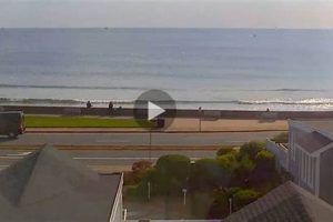
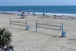
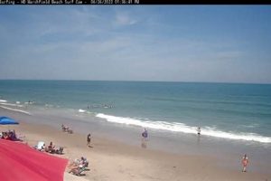
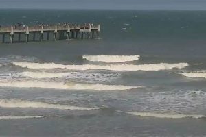
Live video feeds focused on coastal areas provide real-time observation of surf conditions. These web-based cameras offer a continuous stream of visual data depicting wave height, frequency, and overall ocean activity at a specific beach location. For example, one might observe the wave patterns forming at a popular surfing destination through a publicly accessible stream.
The value of this technology lies in its ability to remotely inform individuals about the current environmental conditions. Surfers, lifeguards, and coastal researchers alike benefit from the readily available and up-to-date information. Historically, reliance was placed upon subjective observation, but these resources offer an objective and consistent data source. Such visual data contributes to improved safety, efficient resource allocation, and enhanced recreational planning.
The subsequent sections will detail the specific advantages of using these observation tools, exploring how they impact surfing communities, coastal safety protocols, and scientific research endeavors. We will examine the various types of cameras employed, the technology behind their operation, and the potential future developments in this field.
Tips for Utilizing Coastal Observation Resources
The effective use of web-based coastal observation tools enhances safety, improves recreational planning, and supports informed decision-making related to ocean activities.
Tip 1: Assess Wave Height and Period. Prior to engaging in water sports, evaluate wave height and the interval between waves. High waves coupled with short periods often indicate turbulent and potentially hazardous conditions.
Tip 2: Analyze Current Strength. Look for visual cues indicating the presence of strong currents. Rip currents, identifiable by their discoloration or break in wave patterns, pose a significant risk to swimmers and surfers.
Tip 3: Evaluate Crowd Density. Determine the number of individuals in the water to assess the potential for collisions or interference. Overcrowded conditions can increase the risk of accidents, particularly for inexperienced participants.
Tip 4: Observe Tidal Stage. Be aware of the current tidal stage and its impact on wave patterns and current strength. Incoming and outgoing tides can significantly alter water conditions and pose unique challenges.
Tip 5: Consider Visibility Conditions. Assess the level of visibility, particularly in foggy or low-light conditions. Reduced visibility can impair judgment and increase the risk of encountering unseen obstacles or hazards.
Tip 6: Note Environmental Factors. Consider weather patterns, including wind direction and intensity. Onshore winds can create choppy conditions, while offshore winds may result in unexpected wave formations.
Tip 7: Consult Multiple Sources. Do not rely solely on a single stream. Corroborate the visual data with additional sources, such as weather forecasts and lifeguard reports, for a comprehensive understanding of current conditions.
By employing these strategies, individuals can make informed judgments regarding participation in ocean activities. This promotes safer experiences and demonstrates a responsible approach to utilizing coastal resources.
The subsequent section will address the technological aspects of these systems, providing insight into the hardware, software, and data transmission methods employed.
1. Real-time Data
The instantaneous transmission of visual information regarding surf conditions is fundamental to the utility of coastal observation systems. Real-time data allows for immediate assessment and decision-making based on current environmental factors.
- Immediate Hazard Assessment
The rapid dissemination of imagery permits immediate evaluation of potentially dangerous conditions. For instance, sudden increases in wave height or the development of strong rip currents can be observed and communicated to relevant parties, mitigating potential risks. This is exemplified by systems installed after major coastal flooding events to proactively monitor rising water levels.
- Optimized Recreational Planning
Surfers, swimmers, and other recreational users can utilize real-time feeds to plan activities based on present conditions. A live view enables individuals to determine if wave quality is suitable for surfing or if swimming conditions are safe. This is particularly valuable in regions with rapidly changing weather patterns, such as the Pacific Northwest, where conditions can shift dramatically within hours.
- Enhanced Coastal Management
Local authorities and coastal management agencies can leverage real-time data for informed decision-making regarding beach closures, lifeguard deployment, and emergency response planning. Continuous monitoring allows for the identification of developing hazards and proactive implementation of safety protocols, such as raising hazard flags. Systems integrated with local weather patterns can anticipate storm patterns.
- Scientific Data Collection Support
Researchers can utilize visual feeds to supplement scientific data collection efforts. Real-time imagery can provide valuable contextual information regarding wave patterns, sediment transport, and coastal erosion processes. This data can be used to validate models and improve understanding of coastal dynamics, improving the data set.
These multifaceted applications of immediate visual information highlight the importance of continuous data streams in the context of coastal observation systems. The ability to access up-to-the-minute environmental data empowers individuals, agencies, and researchers alike, promoting safer and more informed interactions with the coastal environment.
2. Wave Height Analysis
Wave height analysis, a critical component of any coastal observation system, directly relies upon the visual data provided by these resources. The ability to remotely and consistently measure wave height offers significant advantages over traditional methods, impacting coastal safety, recreational planning, and scientific research. The imagery captured allows for quantitative analysis, extracting numerical data regarding wave size and frequency. For instance, visual feeds deployed at popular surf breaks, such as those found along the coast of California, enable surfers to remotely assess wave conditions before traveling to the location, minimizing wasted time and potentially hazardous situations. This functionality stems directly from the accurate measurement of vertical distance between the crest and trough of waves within the field of view.
Beyond individual recreational use, wave height analysis facilitates informed decision-making by coastal management agencies. Data regarding wave characteristics, extracted from consistent feeds, assists in predicting coastal erosion, informing beach nourishment projects, and optimizing the placement of coastal defenses. After major storm events, analysis of wave heights recorded by these systems aids in assessing storm surge impact and validating predictive models. Integration of wave height data with other environmental parameters, such as wind speed and direction, yields a more complete picture of coastal dynamics, allowing for more accurate forecasting and improved safety protocols.
In summary, wave height analysis, enabled by the use of visual observation tools, constitutes a crucial element of coastal management and safety. The continuous and objective data stream provides a foundation for informed decisions, ranging from individual recreational planning to large-scale coastal protection measures. Challenges remain in accurately calibrating systems, particularly in areas with complex bathymetry or variable lighting conditions; however, ongoing advancements in image processing and data analysis techniques continue to improve the accuracy and reliability of this essential tool.
3. Coastal Safety Enhancement
Coastal safety enhancement benefits directly from the real-time visual information provided by strategically placed observation systems. These deployments facilitate continuous monitoring of ocean conditions, enabling proactive measures to mitigate risks and ensure public safety along coastlines. The objective data assists in risk assessment and resource allocation.
- Rip Current Detection and Alerting
Visual observation facilitates the identification of rip currents, a significant hazard to swimmers. Trained personnel can monitor streams for telltale signs of these currentsdiscoloration, breaks in wave patternsand issue timely warnings to beachgoers. Furthermore, automated image analysis algorithms are increasingly being employed to automatically detect and flag potential rip current formations, further enhancing the speed and accuracy of hazard detection. This technology is crucial in areas known for frequent rip current activity. Examples are commonly used at Australian Beaches with warning systems in place.
- Wave Hazard Monitoring
Sudden increases in wave height and frequency pose a threat to both swimmers and surfers. Live visual streams enable continuous monitoring of wave conditions, allowing lifeguards to anticipate and respond to potentially dangerous situations. Systems provide crucial information during storm surges, assisting in evacuation planning and minimizing property damage. Coastal communities in hurricane-prone regions greatly benefit from access to this real-time hazard assessment data.
- Improved Lifeguard Response Times
Visual data assists lifeguards in rapidly assessing emergency situations and deploying resources effectively. Remote observation of incidents allows lifeguards to prepare for rescue operations before arriving on the scene, potentially reducing response times and improving outcomes. Systems provide a comprehensive overview of beach conditions, ensuring lifeguards are aware of potential hazards and can make informed decisions regarding resource allocation.
- Enhanced Public Awareness
Visual streams serve as a valuable educational tool, raising public awareness of coastal hazards. Displaying live conditions at beach entrances or on public websites informs beachgoers about current risks and encourages safe behavior. Educational programs can utilize historical data to illustrate the dynamics of coastal processes and the importance of respecting the ocean. The availability of this information empowers individuals to make informed decisions and promotes a culture of coastal safety.
The integration of visual monitoring systems into coastal safety protocols represents a significant advancement in risk management. By providing real-time information and enhancing situational awareness, these tools contribute to a safer and more enjoyable coastal experience for all. While technological limitations exist, ongoing developments in image processing and data analysis promise to further enhance the effectiveness of these essential safety measures.
4. Recreational Planning Tool
Coastal observation systems serve as integral resources for recreational planning, providing individuals with objective, real-time information to inform decisions regarding beach activities. The accessibility of these visual feeds empowers users to assess conditions remotely, optimizing their coastal experiences.
- Surf Condition Assessment
These resources enable surfers to evaluate wave height, period, and break patterns before traveling to a location. This minimizes wasted travel time and ensures that individuals arrive at beaches with conditions suitable for their skill level. For instance, a surfer can assess a specific surf break, such as Huntington Beach, CA, to determine if the wave conditions meet their preferences before making the trip.
- Swimming Safety Evaluation
Swimmers can utilize these feeds to assess water clarity, the presence of rip currents, and the number of other individuals in the water. By visually assessing these factors, swimmers can make informed decisions about the safety of entering the water at a particular location. For example, a family planning a beach trip can assess the calm conditions at Coronado Beach, CA, ensuring a safe swimming environment for children.
- Tide Monitoring for Fishing and Shelling
Fishermen and those interested in shelling can monitor tidal conditions using these systems. Knowing the tide level enables individuals to predict the best times for fishing or collecting shells. Examples of this includes monitoring systems located at Morro Bay, CA, to determine the optimal tides for clamming and other intertidal activities.
- Crowd Density Assessment
Individuals can assess crowd levels before heading to the beach, allowing them to choose locations with more space and avoid overcrowded areas. This is particularly useful during peak season or on holidays when popular beaches can become congested. For instance, individuals planning a trip to South Beach, Miami can utilize feeds to determine the level of overcrowding before committing to the location.
The multifaceted applications of visual observation systems demonstrate their value as a recreational planning resource. By providing objective, real-time information, these tools empower individuals to make informed decisions about their coastal activities, enhancing safety, optimizing experiences, and promoting responsible use of coastal resources. The value lies in accessibility and integration with other weather data points.
5. Equipment Longevity Factors
The operational lifespan of coastal observation equipment is intrinsically linked to various environmental and technological considerations. The corrosive nature of saltwater, extreme weather conditions, and the potential for vandalism present significant challenges to the sustained functionality of these systems. Selecting appropriate materials, implementing robust protective measures, and establishing proactive maintenance schedules are crucial for maximizing equipment longevity in these demanding environments. Failure to address these factors results in increased downtime, higher replacement costs, and a reduction in the availability of real-time coastal data.
Protective housings constructed from marine-grade stainless steel or specialized polymers mitigate the corrosive effects of saltwater spray. Strategic placement of equipment, considering prevailing wind patterns and tidal ranges, reduces exposure to extreme environmental conditions. Regular inspections, cleaning, and component replacements, performed as part of a structured maintenance program, address wear and tear before it leads to system failure. The integration of remote monitoring capabilities allows for the early detection of malfunctions, enabling proactive intervention and minimizing downtime. An example includes the implementation of self-cleaning lenses on cameras deployed in areas with high levels of airborne sand, reducing the need for frequent manual cleaning and extending the operational period between maintenance cycles.
In summary, ensuring the longevity of coastal observation equipment requires a holistic approach, encompassing careful material selection, strategic placement, and proactive maintenance. By addressing the challenges posed by the harsh coastal environment, the reliability and availability of this vital technology is enhanced, ultimately contributing to improved coastal safety, more effective recreational planning, and better-informed coastal management decisions. Sustained investment in equipment durability is crucial for maximizing the return on investment and realizing the full potential of coastal observation systems.
6. Environmental Data Integration
The incorporation of diverse environmental parameters alongside visual data from coastal observation systems significantly enhances their utility and predictive capabilities. Integrating metrics such as wind speed, tide levels, water temperature, and atmospheric pressure with real-time imagery allows for a more comprehensive understanding of coastal dynamics. This synergy provides a holistic view exceeding the limitations of solely visual assessments, improving forecasting accuracy and enabling more informed decision-making.
The presence of strong winds, especially offshore winds, can alter wave shapes and size, greatly affecting suitability for surfing. Integration of anemometer data with the observation feed offers surfers advanced information beyond visual appearance. Similarly, tidal influences greatly affect safe swimming zones and risk. Integration of tidal level details on these feeds allows beachgoers to evaluate dangers that may not be visually detectable. The National Oceanographic and Atmospheric Administration (NOAA) integrates information from various coastal data sources, including video feeds, to provide comprehensive regional forecasts, demonstrating the practical application of data synergy in enhancing predictive capabilities.
Challenges remain in harmonizing disparate data streams and ensuring data quality across varied sensor types. However, the benefits of environmental data integration into coastal observation systems are substantial, empowering more effective coastal management, enhancing recreational experiences, and improving hazard prediction. The ability to synthesize visual and environmental information provides a powerful tool for understanding and responding to the dynamic coastal environment.
7. Accessibility Challenges Mitigation
Effective delivery of visual data from coastal observation systems necessitates deliberate mitigation of accessibility challenges. Barriers to access, encompassing technological, economic, and geographic factors, impede the widespread utilization of this data and limit the benefits derived from real-time coastal monitoring. Addressing these impediments is crucial for ensuring equitable access to information that informs safety, recreation, and coastal management decisions.
- Bandwidth Limitations
High-resolution video streams require significant bandwidth, posing a challenge for users with limited or unreliable internet connectivity. Compressing video feeds without sacrificing essential visual information is imperative for expanding accessibility, particularly in rural or underserved areas. Adaptive streaming technologies, which adjust video quality based on available bandwidth, offer a practical solution for accommodating users with varying internet speeds. Municipal initiatives can enhance the local access points through public wi-fi accessibility.
- Device Compatibility
Ensuring compatibility across a range of devices, including smartphones, tablets, and desktop computers, is essential for maximizing accessibility. Designing websites and applications with responsive layouts and cross-platform compatibility broadens the potential user base. Employing web standards and avoiding proprietary technologies promotes universal access, regardless of device type. Regularly testing performance across different platforms helps to maintain a consistent user experience.
- Digital Literacy
A lack of digital literacy can hinder the ability of individuals to effectively utilize coastal observation resources. Providing user-friendly interfaces, clear instructions, and multilingual support enhances accessibility for individuals with varying levels of technological proficiency. Developing educational materials and conducting outreach programs can promote digital literacy and empower users to confidently access and interpret coastal data. Accessible public computer access in libraries enhances accessibility.
- Sensory Impairments
Individuals with visual or auditory impairments require specialized accommodations to access visual data from coastal systems. Providing alternative text descriptions for images, captions for videos, and screen reader compatibility ensures that information is accessible to a wider audience. Implementing accessibility standards, such as the Web Content Accessibility Guidelines (WCAG), promotes inclusive design and broadens access for users with disabilities. Audio descriptions of visual wave patterns allows visually impaired surfers the ability to virtually access the surf conditions.
Addressing accessibility challenges is paramount for realizing the full potential of coastal observation systems. By mitigating barriers to access, these resources can effectively serve a diverse user base, promoting safer coastal practices, enhancing recreational experiences, and supporting informed decision-making regarding coastal management and conservation. Sustainable funding models are vital for long-term access maintenance.
Frequently Asked Questions Regarding Coastal Observation Systems
This section addresses common inquiries concerning the functionality, limitations, and applications of coastal observation technologies. Clarification of these points promotes informed utilization of these resources.
Question 1: What factors limit the visibility range of these systems?
Atmospheric conditions, including fog, rain, and haze, significantly reduce the effective viewing distance. Additionally, the curvature of the earth and the height of the camera above sea level constrain the observable horizon. Image quality degrades with distance due to atmospheric scattering and limitations in sensor resolution.
Question 2: How frequently are the images updated?
Update frequency varies depending on the system configuration and available bandwidth. Some systems provide near real-time imagery, updating every few seconds, while others update at longer intervals, ranging from minutes to hours. Update frequency impacts the ability to observe rapidly changing conditions.
Question 3: Are historical data records available for retrospective analysis?
Availability of archived imagery depends on the storage capacity and data management policies of the system operator. Some operators maintain extensive archives, allowing for the analysis of long-term coastal trends, while others retain data for shorter periods or not at all. Accessibility to archives must be confirmed with specific providers.
Question 4: What measures are in place to protect privacy?
Systems are typically deployed in public areas and capture broad overviews of coastal regions. Identifying individuals is generally difficult due to the distance and resolution of the cameras. However, ethical considerations require careful attention to privacy concerns, and operators should implement measures to minimize the risk of compromising personal information.
Question 5: How accurate is the wave height data derived from visual streams?
Accuracy of wave height measurements depends on factors such as camera calibration, image resolution, and the algorithms used for analysis. While visual estimates can provide a general indication of wave conditions, they may not be as precise as measurements obtained from dedicated wave buoys or other scientific instruments. Comparative studies are recommended.
Question 6: Who is responsible for maintaining these observation systems?
Maintenance responsibilities typically fall to the organization that operates the system, which may be a government agency, research institution, or private company. Funding sources for maintenance and upgrades vary depending on the system and its intended purpose. Public access to the identity of operating bodies offers greater accountability.
These clarifications address common concerns related to the utility and reliability of coastal observation resources. Understanding these factors is crucial for responsible and informed utilization of the data provided.
The succeeding section provides a comparative analysis of various coastal observation technologies, highlighting their respective strengths and limitations.
Surf Cam Ocean Beach
This exploration of visual data resources has illuminated their role in coastal management, recreation, and safety. The accessibility and real-time nature of these streams offer significant benefits, providing critical information for a range of stakeholders. Wave height analysis, hazard monitoring, and informed planning are all enhanced through the strategic deployment and utilization of coastal observation systems. However, considerations surrounding data accuracy, accessibility, and equipment maintenance remain paramount for sustained effectiveness.
The continued development and refinement of observation technologies is essential for ensuring the long-term resilience and responsible use of coastal environments. Ongoing investment in infrastructure, data integration, and accessibility initiatives will maximize the societal benefits derived from these systems, fostering safer and more sustainable interactions with the world’s coastlines. This technology needs constant evaluation and community feedback to offer effective solutions.


